


Awesome Caminito del Rey
Another journey along the Caminito del Rey is now behind me, and with each visit, my appreciation for this place deepens. This time, I explored the trail early in the morning without a human guide, armed only with a mobile guide to Caminito del Rey.
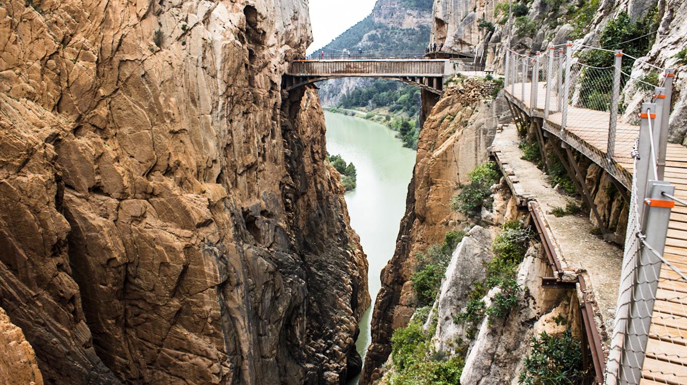
The allure of the Caminito del Rey is twofold. Firstly, there is the breathtaking Desfiladero de los Gaitanes, comprised of two canyons separated by a charming valley. For many, the stunning natural beauty of these canyons is the primary draw—and justifiably so.
However, there is another, often overlooked aspect of the Caminito that captivates me: its rich history, shaped by a pioneering engineer who constructed a hydroelectric power station here in the early 20th century. The modern narrative of the canyon is intertwined with the rise and eventual decommissioning of this facility, a remarkable tale of hydro-engineering that dates back to the last century. Unravelling the details of this historical feat proved to be as captivating as the awe-inspiring landscapes of the canyon itself.
The Fascinating Caminito del Rey: A Testament to Early 20th Century Engineering
As the 20th century dawned, Málaga was transforming into a burgeoning industrial hub, with rapid development across various sectors. This industrial boom increased the demand for electricity, yet prices remained steep, influenced both by the high cost of coal and the policies of foreign-owned power companies. It was against this backdrop that local authorities began the quest for an affordable, local energy solution.
Enter Rafael Benjumea y Burín, a scion of a prominent bourgeois family in Málaga. Like many of his contemporaries, Benjumea was driven to find a location to establish a cost-effective hydroelectric power station that could support the city’s growing energy needs. Initially, the Desfiladero de los Gaitanes seemed an unlikely candidate due to its topographical limitations—hydroelectric stations require significant height differentials to create the water drop essential for driving the turbines that generate electricity.
An Ingenious Idea
Upon closer inspection of the terrain, Rafael Benjumea hatched a plan marked by brilliant simplicity. He constructed a small dam just before the canyon narrowed significantly, blocking the river and diverting part of its flow into a four-kilometre long channel. This canal, unlike the river that cascaded down the steep canyon, maintained only a gentle gradient. At its terminus, the elevation difference between the canal’s outlet at the top and the river at the canyon’s base exceeded 100 metres—a perfect setup for generating hydroelectric power.
Subsequently, power station buildings equipped with turbines were constructed along the riverbank. Water was channeled through a large pipe from the canal’s end, cascading steeply downward to drive the turbines, thereby generating electricity to fuel the burgeoning growth of Málaga.
The innovative design of this dam not only maximized the hydraulic potential but also significantly reduced construction costs, a crucial factor in any infrastructure project. However, in today’s world, such a project might face insurmountable challenges. Environmental concerns and the preservation of natural landscapes would likely hinder its implementation, as the construction dramatically altered the canyon’s landscape and significantly impacted the ecosystem.

So, How Does It Work?
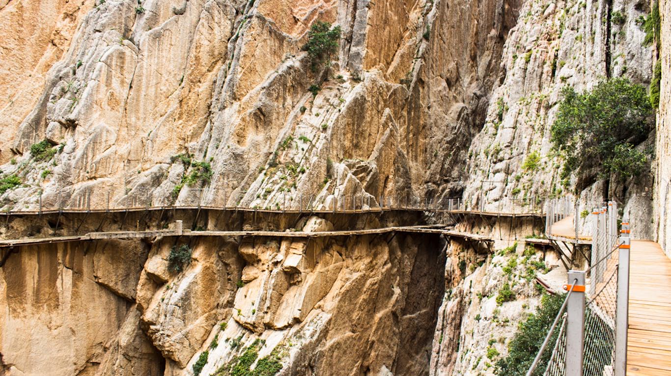
At the very beginning of the path, you can see the dam, a crucial part of the hydroelectric system. Its lower section was responsible for damming up the water and directing it into a canal that led to the power station. This section is prominently visible near the disused gates—the original entrance to the trail—flanked by two memorial plaques.
The canal, originating here, extended approximately four kilometres along the west side of the gorge. It navigated through rock-carved tunnels and along aqueduct-like structures, transporting ten thousand litres of water per second. At the lower canyon’s entrance, it crossed a dramatic-looking bridge, ultimately passing over the railway line and other obstacles to reach the power station.
The canal’s final stretch transformed into a waterfall, aptly named ‘El Salto del Chorro’ (The Chorro Jump). At this point, the water cascaded down the slope directly above the power station, gaining tremendous speed, enough to drive turbines and generate inexpensive electricity.
So, what exactly is the Caminito del Rey, or ‘Path of the King’? It is nothing more than an old service road initially used by the power station workers. The path remained in operation as long as the power station itself was active.
Caminito del Rey Today
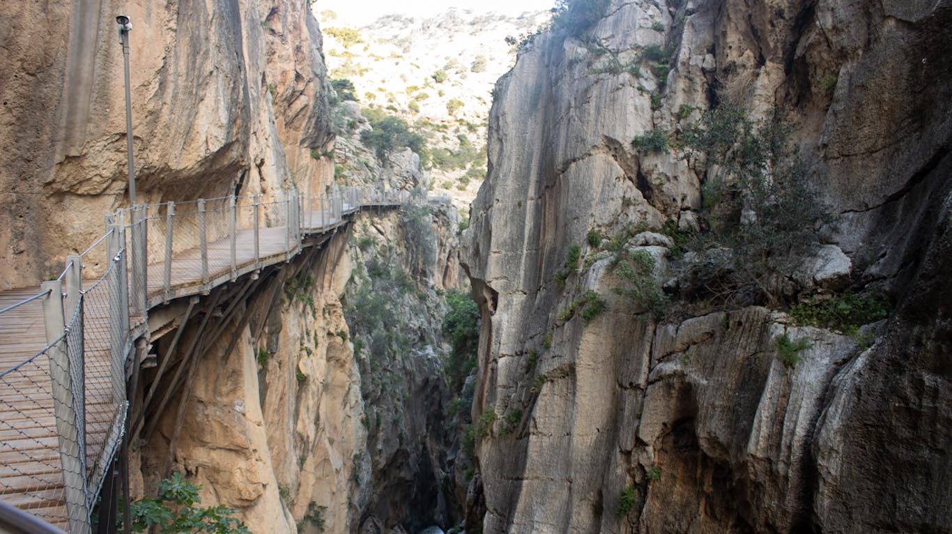
A masterpiece of early 20th-century hydraulic engineering, the Caminito del Rey has partially survived to our times. The dam and much of the canal, especially those sections carved into the rock, remain intact. Unfortunately, the original power station had to be demolished to make room for the new El Chorro reservoir, which serves a modern pumped-storage power station by the same name. The old service path has also succumbed to the ravages of time, having disintegrated after nearly a century of use. While traces of the old path still exist, it is no longer safe for public access.
In 2015, a new era began with the opening of the ‘Caminito del Rey’ hiking trail. This trail often runs just above the remains of the old path, providing a safe and scenic route for modern adventurers.
You are warmly invited to join us for a walk along this historic trail. For those eager to delve deeper into the canyon’s story as you explore, I recommend downloading our mobile app for the Costa del Sol, which includes an English audio guide to the Caminito del Rey!